
The tri-state marker between Indiana, Michigan, and Ohio erected by Hillsdale County Historical Society in 1977. Anna Broussard | Collegian
State senator secures funding to properly mark official border with Indiana
Parts of the Indiana and Michigan border line are unknown, and Michigan Sen. Jonathan Lindsey, a Republican representing parts of Branch and Hillsdale County, secured funding for a bill in December 2025 to sharpen the blurry line between the states.
Michigan has been in border disputes since before it was a state. Its original border survey, completed in 1827, never clarified to residents where the lines fell, making it particularly difficult for people living along the lines of Michigan and Indiana.
“The uncertainty surrounding the exact border between the two states has caused a number of issues over the years, and previous efforts have been affected by unexpected setbacks that prevented the project from being completed,” Lindsey said in a statement. “My bill is a simple fix that will prevent having to start this process over again from the beginning.”
Michigan’s first land controversy, the 1835 Toledo War, resulted in Ohio getting the Toledo Strip and Michigan getting the Upper Peninsula. The second dispute regarding territory between Wisconsin and Michigan was decided by the U.S. Supreme Court in 1836, granting a water and land boundary in the U.P.
Senate Bill 595, introduced by Lindsey, secured around $500,000 to accurately assess the proper markings for the state line between Indiana and Michigan. The bill allows for county surveyors using the 1872 survey, GPS mapping, and remonumentation programs to determine the official state lines.
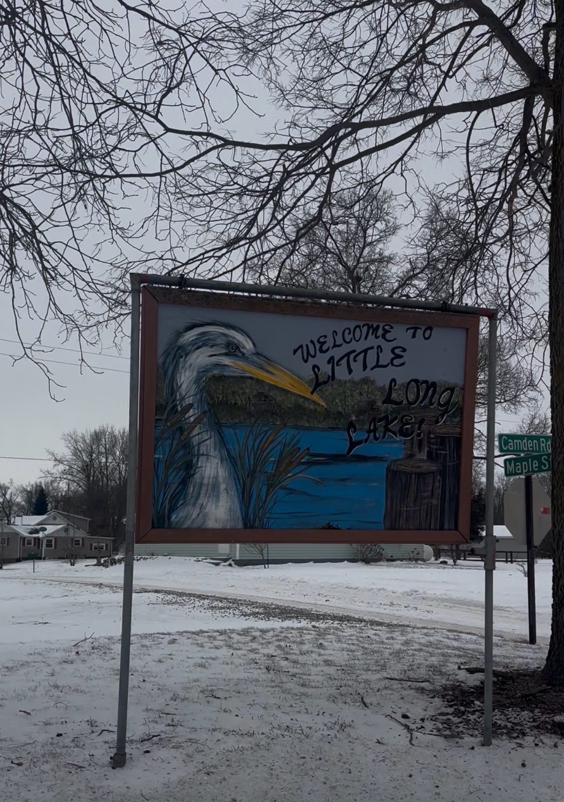
Little Long Lake, which is divided by Indiana and Michigan. Anna Broussard | Collegian
“It is past time we accurately survey and remonument the Michigan-Indiana border, which has not been done since before we became a state,” Lindsey said.
Lindsey’s bill, which was signed by Gov. Gretchen Whitmer in December 2025, took effect in January and will continue through 2030 to establish a boundary line benefiting residents and avoiding general territory conflicts.
According to Michigan Sen. Joseph Bellino, R-Monroe, the effort to establish a clear border has been ongoing since 2016, when he first began in the Michigan Senate.
“Jonathan’s bill, it gives it right back to the counties and townships to do it and get it done,” Bellino said. “We don’t have this problem with the Ohio–Michigan border, but we do with Indiana.”
Bellino said the hope is that the state line changes over a matter of 10 to15 feet, and it is not expected to create a conflict for those in Hillsdale County.
“We like Indiana,” Bellino said. “Indiana gave us a place to eat during COVID-19. Indiana gives us a lot of opportunities. I can’t imagine this would be a fight if they got to move it a few feet.”
A tri-state landmark established in 1977 marks the
junction point where Michigan, Ohio, and Indiana meet, but where the border lines continue from there remains unclear. Unlike Michigan’s borders with Ohio and Wisconsin, which were settled through conflict and court rulings, the Indiana border has a single marker that stands as the official tri-state boundary point.
“I’ve always been interested in the sign of the entry of the state,” Battle Creek resident Kani said, who was visiting the landmark, said. “I have seen this place from Google Maps, and it connects the three states Indiana, Ohio, Michigan and I have been wanting to come here for the longest time.”
The marker, which is engraved on a rock with miles of fields surrounding it, leaves no clear indication of where the state boundaries actually run.
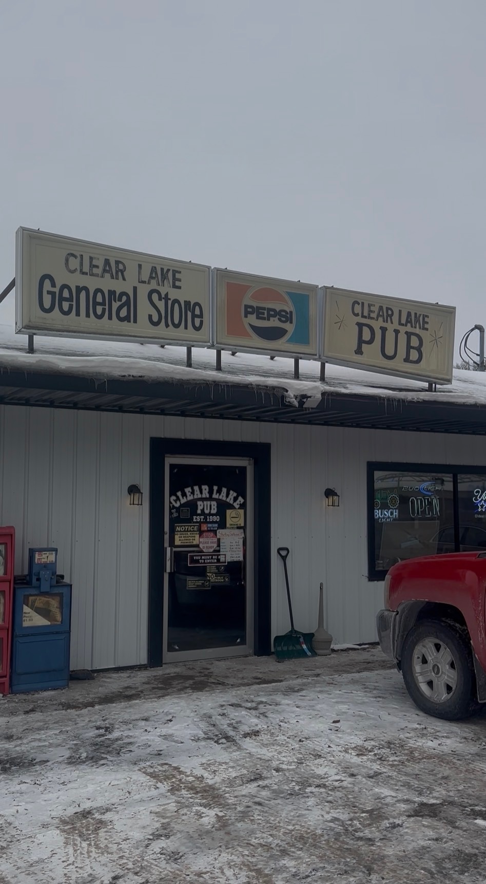
Clear Lake General Store, close to the disputed border. Anna Broussard | Collegian
According to locals in Clear Lake, Indiana, the unclear boundary lines cause issues with conflicting state laws. On nearby Little Long Lake, the supposed border runs straight through the middle of the lake.
“You need both a Michigan license and an Indiana one to ice fish on that lake,” Indiana resident Chase Eichler said. “I’ve heard from regulars that live over there that if you are on the Indiana side, you’re only allowed to go a certain speed, and after a certain time, your boats have to be off the water. But then on the Michigan side you can be loud and stay out longer.”
Eichler said he determines the state lines depending on how quickly the snow is plowed off the roads.
“The only way I know what state I’m driving in here is the roads are numbered in Indiana, and the ones in Michigan have names,” Indiana resident Chase Eichler said. “Indiana is a little bit better with the snowplows, but I don’t think we will ever really know where the border was originally meant to be in the first place.”
![]()